Tuesday, September 29, 2009

Boston24: The Launch: Boston Designers To Watch


The Launch celebrated Boston's up and coming fashion designs for Boston's Fashion Week in September, where the emphasis was on the clothes. So here are some photos I took for Boston24.


I included this one because he reminds me of Dr. Horrible.

Tuesday, September 1, 2009

Boston24: Movin' Day


This is kinda a bit old, but I took these photos of Boston's (in)famous moving day, when all the college kids that fled Boston during the summer returned back to the coop (Get it? The Coop? The Harvard Co-op? I'm kinda proud of myself for bad Boston humor.) Anyway, I shot this photoessay for my friend Valeria's website, Boston24.

Tuesday, August 25, 2009

Metro: Link up to get ahead


In Metro:

How social networking can help and hurt your career

As the old adage about getting ahead goes — it all depends on who you know. In prehistoric times (before Facebook, LinkedIn and Twitter), in order to expand your professional contacts, you would have to attend networking conferences and awkward work happy hours. But now, because of such sites, your social and professional networks have expanded indefinitely. And as many experts point out, it’s up to you to navigate it correctly.

“Social networking gives you the opportunity to build relationships with people across the globe, 365 days a year,” says Rebekah Hudder, a social media specialist. “It opens doors to meeting new people who could be potential clients, referral sources or employers. You can further your career and promote your personal brand recognition.”

But with the ease of the Internet comes the constant work of updating your pages and maintaining proper relationships online, as Diane Coffey, a public relations manager at Kel & Partners, a Web marketing firm, points out. “You need to give more than you receive. Be ready to offer information that can help others. People don’t forget who helped lead them to a great job opportunity.”

However, online social networking can also be detrimental because if you’re using it, you can bet potential human resources managers and bosses have seen your profile.

“Social networking can end your career as fast as you can say the word ‘Facebook,’” says Stephen Viscusi, founder of Bulletproofyourresume.com. “No boss would admit it, but every HR department uses it to make hires and fires.”

And in the end, you can’t forget about your old ways of connecting with contacts. “Social networking sites are used to connect with people,” says Coffey. “But they can only take you so far. Jobseekers should use social networking sites as a way to begin a relationship with a potential employer.”

Saturday, August 22, 2009

The L Magazine: Museums Go To War on the High Seas of Queens


On The L Magazine:

I left Duke Riley’s Naumachia (Latin for “naval battle”) completely soaked and covered with dried fake blood and tomato bits and completely satisfied. But before we get into all that, what exactly is the Naumachia?

Duke Riley, rogue waterfront artist extraordinaire, with help from the Queens Museum, called for homemade boats to participate in an epic, Roman-style live battle. Using the abandoned hockey rink attached to the Queens Museum as a boat shop, Riley and participants built recycled boats, using items like reeds from beaches and even materials from the hockey rink itself.
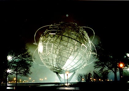
Before the battle, toga-clad spectators and participants crowded into the lobby of the Queens Museum of Art, downing free special lemonade after beer after wine. (Alcohol was free to those donning togas.) Last minute preparations were still being made with the boats. The battle would take place at the reflecting pool at Flushing Meadows Park in Queens, former home of the 1964 World’s Fair, within view of the Unisphere.

Families walked around with children, who waded in the pool. Darkness soon settled, and floodlights bathed the pool in light. The audience was getting restless, and took advantage of the boxes of bread and tomatoes that lay around the area, begging to be used, bombarding members of each side.

And then the battle really began. Each ship came out to be greeted by cheering and tomatoes. From my vantage point, it was difficult to see exactly what was going on, as the scene was shrouded in smoke, criss-crossed with flying tomatoes, and obscured behind huge splashes of water. Nevertheless, chaos ruled the scene. Bystanders jumped into the pool, taking part in the battle themselves. When the pigboat sailed in in all its swine-y glory, the audience gleefully jumped aboard.

Near the end, a replica of Riley’s favorite ship, the Queen Mary 2, came out and was promptly set on fire, as the battle went on around it. Soon, fireworks rocketed out of the ship, nearly hitting the audience at times.

According to other sources, since I couldn’t tell what exactly went on, the Queens Museum won the battle, but really, everyone did, in his or her own way – I even spotted a few audience members lugging chunks of boats back to the 7 train.

For the rest of the photos, go here.

Monday, August 17, 2009

Metro: Row, row, row a boat in Brooklyn


In Metro:

PREVIEW. Instead of walking around New York, wouldn’t it be so much nicer to float around New York? It’s possible in Brooklyn, thanks to the Village Community Boathouse (VCB) and the Downtown Boathouse (DB).

The two nonprofit organizations are offering community rowing and kayaking every Saturday in August at DUMBO Cove in Brooklyn.

The idea behind the program is, “to introduce Brooklynites to on-water recreation,” says Rob Buchanan, president of VCB. “And to build citizen support for a flourishing network of community boathouses all along the Brooklyn side of the East River.” If you’re still interested after an East River paddle this summer, both groups offer rowing and paddling all season long.

Community rowing and kayaking

DUMBO Cove

Saturday, 2-6 p.m.
Brooklyn Bridge Park
End of Main and Plymouth streets
Aug. 22, 11-3 p.m.
Aug. 29, 2-6 p.m.

www.villagecommunityboathouse.org

www.downtownboathouse.org

Sunday, August 9, 2009

Metro: You need a ‘Hero’? Chris Kattan goes full-on Bollywood in new IFC miniseries


Chris Kattan, left, knows a thing or two about cheesy dancing. Photo courtesy of IFC.

In Metro:

Cue swirling bright colors, dancing, extravagant sets, and lip-synced Hindi songs. This isn’t a typical Bollywood flick however, it’s “Bollywood Hero,” IFC’s new original miniseries. Chris Kattan, formerly of “Saturday Night Live,” stars in “Bollywood Hero” as, essentially, himself. Kattan becomes tired of Hollywood so when he’s offered a starring role in a Bollywood film, he goes to India.

“To make fun of Mango and Mr. Peepers [two of Kattan’s “SNL” characters] and play someone grounded and real was attractive to me,” he says. “It was great working with some of the most beautiful women [I’ve seen] in my life. It doesn’t happen that often.”

But “Bollywood Hero” isn’t all dance numbers and gorgeous ladies. The miniseries also offers glimpses of India’s underside — the tiny shacks in crowded slums.

“The poverty situation is strong there and reminded me this is what’s going on outside my little box, but we can make a difference,” he admitted. The L.A. screening of “Bollywood Hero” helped fund Project Crayons, a Mumbai-based organization that helps orphanages like the ones used in the miniseries.

Kattan hopes that “Bollywood Hero” will mark a new direction for his career post-“SNL.” “It’s kind of a change for me, getting smart stuff. It’s nice to get acknowledged in that area,” he says. “It’s a big step from Mr. Peepers.”

‘Bollywood Hero’
Thursday, Friday, Saturday
10 p.m., IFC

And just because I went to the premiere and got a picture with him:

The L Magazine: Governors Island: Reimagined and Still Creepy


My second L Magazine photoessay, about the PLOT09 art exhibit on Governors Island. Text on the site by Hannah Levine.

The L Magazine: The High Line: West Side Story with a Happy Ending


My first L Magazine (website) piece, a photoessay on the opening of the then-new High Line, in Chelsea.

Friday, July 31, 2009

The L Magazine: Mapping Mannahatta, The Original Manhattan


Markley Boyer, The Mannahatta Project, Wildlife Conservation Society

On The L Magazine:

Picture a time when Kips and Turtle Bays were actual bays, and East Harlem was nothing but plains. When Queens and Brooklyn were still considered part of Long Island, the was Bronx part of Westchester, and the center of New York was just Manhattan. Now it’s a paved paradise with buildings, streets and sidewalks, but back then two-thirds of that island were covered in green forests. Deer, otters, bobcats, and rabbits roamed the thickets. The island was smaller then: 11,817 acres instead of its current 13,690 acres. When Mannahatta was truly the island of many hills, as the Lenape Indians, the original New Yorkers, called it. Welcome to New York, circa 1609.

It’s been 400 years since Henry Hudson and his crew of the Half-Moon set sail up what would become his namesake river and, my oh my, how New York has changed. Instead of soaring trees, there are towering buildings made of brick and steel. Our urban opera now includes honking motorists, screeching tires, constant chatter, construction noise, jackhammers, and blaring music, with the occasional bird chirp somewhere in the mix.

Even though the wild Manhattan of old is long gone, you can get a sense of it in Mannahatta/Manhattan: A Natural History of New York City, 1609 to 2009, a project helmed by Eric Sanderson, landscape ecologist at the Wildlife Conservation Society (WCS). The endeavor exists both as a book and exhibit form at the Museum of the City of New York.

Eric Sanderson thought he’d always live in northern California, where he grew up and got his PhD in landscape ecology at the University of California, Davis. Then he got a job offer from the WCS, which is headquartered at the Bronx Zoo.

In between his far-flung trips trying to figure out how to conserve international ecological systems, Sanderson made his home on City Island, which he describes as “a little bit like an old fishing village, New York-style.” During the weekends, he ventured into Manhattan and acted like a proper tourist, though he couldn’t turn his mind off. “I would go to the Empire State Building and try to figure out how this landscape works,” Sanderson said. “Like how the savannah in Africa works: how does this ecosystem work in New York? It was so different from what I’ve grown up with.” “Manhattan is so extraordinary,” he continued, “it is the densest place in the United states by twofold.”

Whenever he was about to visit a new location, Sanderson did his research and New York was no exception. Often, he would look at old maps, which greatly intrigued him. This was how he stumbled upon the British Headquarters’ Map, dating from 1872. The map was created during the American Revolution by the British Army to figure out strategic strong and weak points throughout New York in order to protect itself from the Americans. The meticulously detailed map included the original shoreline, elevations, and locations of marshes, streams, wildlife and plant life.

“If you take that map and geo-reference it to the city today, then I could figure out where those streams are,” Sanderson said. “All those features are long lost from the island of Manhattan.” That’s exactly what he did, and armed with the map and a GPS system, he created the Mannahatta Project.

The project illustrates that old Manhattan for us through 3D digital renderings combined with photographs of actual similar and current ecosystems, to help create realistic speculative renderings of the wild island by Markley Boyer.

Select images from the book are presented in the exhibition at the City Museum, along with maps paintings, and written observations from various travelers at the time. The animated 3D map, where the landscape of Mannahatta morphs into that of contemporary Manhattan, is projected in the middle of the room, where it feels a little like a campfire. Meanwhile, signs for each section of the exhibit mimic subway signs.

“I really wanted something beautiful and emotional, so that you could connect it first with your heart, and then with your mind,” he said of the design of the exhibit. “The more time you spend with it, the more you experience it.”

What do you learn? Collect Pond was the biggest source of fresh water on the island. After the local tannery polluted the pond and it was filled in, the location became the swampy area known as Five Points, where violent gangs would fight it out, as depicted in Martin Scorsese’s Gangs of New York. Times Square was home to the confluence of two streams that poured into the Hudson River and to Beaver Pond. The Hudson shores were simply sand banks and the East River shores were marshes.

When asked about further expanding the project to cover the outer boroughs, Sanderson said he had a student working on Queens and Brooklyn right now, but there is no funding, so it’s just a summer project. “Queens had 50 percent wetlands,” he noted.

He is also often asked about creating similar projects for other cities, like London and San Francisco. “Certainly, a lot of other cities in the world, you can do it right,” he said, but there are no further plans.

Currently, Sanderson is working on a competition for architects and landscape designers through a fellowship at the Van Alen Institute. In September 2009, contestants will be invited to work design a sustainable working plan for Manhattan in the year 2409, working within predetermined guidelines. “A beaver needs habitat, and you have to supply food and shelter for it to work,” Sanderson says, “so where is the city going to get those things? What will the city produce, what will it get from the surrounding regions, and get from the world?”

While today’s Manhattan is vastly different from the Manhatta of four centuries ago, Sanderson still believes the city has a bright future. “I’m really optimistic about the future of New York City,” he said. “I think people are really ready and hungry for wanting to know how to live their lives in ways that are meaningful and satisfactory, but not in ways that harm the environment.”

He pointed to architecture and the green revolution as evidence: “People are thinking about how we can live in cities in a resource-efficient manner, and there’s a push to express them more fully. Like green roofs that don’t rely on air conditioning.”

“Even closing streets like we do over the summer and encourage people to ride bikes,” he added. “If you take cars off the streets, it becomes really rideable and fantastic.”

When I asked him about his favorite New York City spot, Sanderson responded enthusiastically: “Inwood Park—the place that’s closest to Manhattan and closest to the Hudson River. It has great, beautiful hills and it’s so far uptown that people still haven’t been there.”

Thursday, July 30, 2009

Queens, the Nabe

Someone at the Metro just asked:

Is Queens a neighborhood or a borough?

...for real?